Guide to Deck 1: Navigation and Communication
10 – Introduction Deck 1: Navigation and Communication
Audioguide:
Humankind strives to experience new things and explore the unknown. The vastness of the ocean is emblematic of human longings.
Exhibition deck 1 deals with navigation and communication at sea.
Busts made especially for the museum recall the voyages of the great explorers. Historical nautical charts and globes bear witness to the world view of the respective epoch.
The development of navigation played a decisive role in the exploration of the seven seas. In our exhibition, compasses, sextants, Morse code devices and signal books illustrate how seafarers kept their bearings and communicated.
Today, seafaring relies on the most modern technology. In the exhibition you will learn everything worth knowing about radar, echo sounder and GPS systems.
The front of the floor is reserved for children. In the „Floating Classroom“ we have games, books and handicrafts for young explorers. There is also the „Queen Mary 2“ – built from almost a million Lego bricks.
Right next to it, experts maintain precious museum objects in our model building workshop. You are cordially invited to look over the shoulders of the staff. Of course, they will also be happy to answer your questions.
11 – The Ancient Knowledge
Audioguide:
People have been sailing the seas since time immemorial. If the land is out of sight, the seafarer must be able to determine his current position and the best possible route. In ancient times, observations of nature were crucial for navigation. The sun and stars showed the seafarers the way. Those who knew the position and movement of the stars were able to orientate themselves at sea.
The oldest representations show the Earth as a disc, but even in antiquity, scholars such as Aristotle, Plato and Pythagoras believed that our planet was a sphere. One indication of the assumption was the observation of the polar star. The position of this fixed star seems to change for the observer depending on where he is. A sailing ship also provides an indication of the curvature of the Earth: of an approaching ship, one first sees the sail and only later the hull.
Scientific cartography goes back to the Greek astronomer and mathematician Claudius Ptolemy. He lived and worked in Alexandria, Egypt, in the second century AD. Ptolemy saw the Earth as the centre of the universe. In his view, all the other stars revolved around this centre. Ptolemy also assumed that the Earth was a sphere.
On the Ptolemaic world map, the Earth is already covered with a network of longitude and latitude lines. It contains an equator and two tropics. The map is an early attempt to transfer the curvature of the earth to a flat surface.
In later centuries, mathematics and observation techniques developed further, especially in the Arab world. From there, ancient knowledge was carried to Europe. The Ptolemaic world map provided the basis for the nautical charts of the 15th century.
On the left side of the room, the exhibition points to the era of the great explorers.
12 – Navigation, Part 1
Audioguide:
The term navigation describes the methods used to determine direction and position at sea. In ancient times, seafarers oriented themselves primarily by prominent landmarks or the position of the stars. This section of the exhibition deals with the beginnings of navigation.
The speed of the ship is measured by the log. An early handlog is a lead-weighted piece of wood attached to a line. The line is tied with knots. If you throw the log overboard, the piece of wood remains in one place on the water. With the help of an hourglass, one determines how many knots have run off the rope in a certain amount of time. Even today, the speed of a ship is indicated in knots.
Depth is measured by the plumb bob. The simple hand plumb consists of a measuring line with a lead weight hanging from the end. Markings are worked into the plumb line at regular intervals. If you let the plumb line slide into shallower water, the marks indicate the water depth. If you fill the lead body of the hand plumb line with tallow, bottom particles stick to it. In this way, information is obtained about the nature of the seabed.
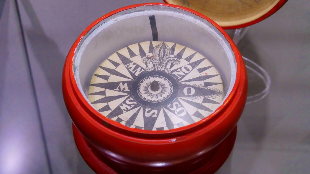
The compass gives the navigator the direction. The rotating compass needle is aligned with the earth’s magnetic field. It points constantly in the direction of north. An exception is the gyro compass, which orients itself to the earth’s rotation. Our museum is proud of the richly decorated crown compasses. They hung under the ceiling of the captain’s cabin and made it possible to follow the course even when lying down. Since the instrument was read from below, east and west are reversed on the compass rose.
13 – Navigation, Part 2
Audioguide:
Among the oldest navigational aids are angle-measuring instruments such as the astrolabe, the Davis quadrant or the Jacob’s staff. With their help, early sailors determined their path along a latitude. Angular instruments helped to calculate the angle of elevation between the pole star and the horizon.
At the beginning of the 17th century, even experienced captains could only estimate their position on the high seas. The exact location could only be found out if the longitude was known in addition to the latitude.
Determining the longitude proved to be much more difficult than determining the latitude. The considerations of John Harrison prevailed. In the 1720s, the English clockmaker devised a method
to determine one’s own position over a fixed degree of longitude – the so-called prime meridian. Harrison developed the chronometer. It is a wheel clock that is set to the time of a reference point. This is usually Greenwich near London. At midday, when the sun is at its highest, the time difference to the highest position of the sun at this reference point is determined. The longitude can be determined from the difference between the two times.
14 – Positioning
Audioguide:
Today, electronic methods are used to determine the position of ships.
Satellite-based GPS systems determine position, course and distance to the destination independently of time and weather conditions.
The abbreviation „GPS“ stands for „Global Positioning Systems“. In the civilian sector, a system developed by the US Department of Defence is used today. A total of 24 satellites continuously orbit the earth. The GPS device on board a ship calculates the distance to the satellite from the data received. By comparing this with two other satellites, the ship’s own position is determined. A constant recalculation determines the direction of movement and speed.
The history of radar goes back to 1904. A radar bearing measures the direction and distance to landmarks, navigation marks or ships. Radar systems have rotating antennas that emit electromagnetic radio waves. As soon as the pulses hit an object, they are reflected and sent back. This all happens at the speed of light. The distance to an object is determined from the signals received.
With the help of an echo sounder, the depth of the water can be determined. Echo sounders send out short sound or ultrasonic pulses. The devices measure the time it takes for the signal to return to the ship as an echo. The echo occurs when the pulse hits another object. This can be the seabed or a school of fish, for example.
15 – Communication
Audioguide:
Until the beginning of the 20th century, there was no communication with ships at sea from land. Contact was only possible with vessels within sight via light, smoke, firecracker and flag signals. Only radio technology helped to bridge the vastness of the oceans.
Messages can be exchanged over short distances by signal flags. Each letter and number is described by its own flag. Some messages are also sent via fixed special signals consisting of up to three letters. The waving alphabet makes an exception: it describes a sign with two identical flags. Different flag positions indicate the letters.
An international basis for communication at sea was first created by the signal book published by the British Board of Trade in 1857. The version valid today contains almost 500,000 signals.
In 1901, the first radio link across the Atlantic was established. This technical innovation fundamentally revolutionised communication. Radio technology made it possible for the first time to make contact with ships out of sight. With the help of electromagnetic waves, information can be transmitted over long distances.
16 – Cartography
Audioguide:
Cartography is the art of depicting our earth or individual areas of land on maps and globes.
However, it is not possible to transfer the curved surface of the earth onto a flat surface without distortion. Cartographers searched for a solution for many centuries.
For exact navigation at sea, seafarers need maps that are true to angle. The mathematician and geographer Gerhard Mercator produced such a map for the first time in 1569. Starting from the equator, Mercator enlarged the latitudes on his map in the direction of the poles. The principle allowed navigators to connect widely separated destinations with straight lines: The lines always intersect the lines of longitude at the same angle. Mercator’s ingenious thinking made compass-guided course charting possible for the first time.
To this day, navigators use the true-angle chart projection that has become known as the „Mercator projection“.
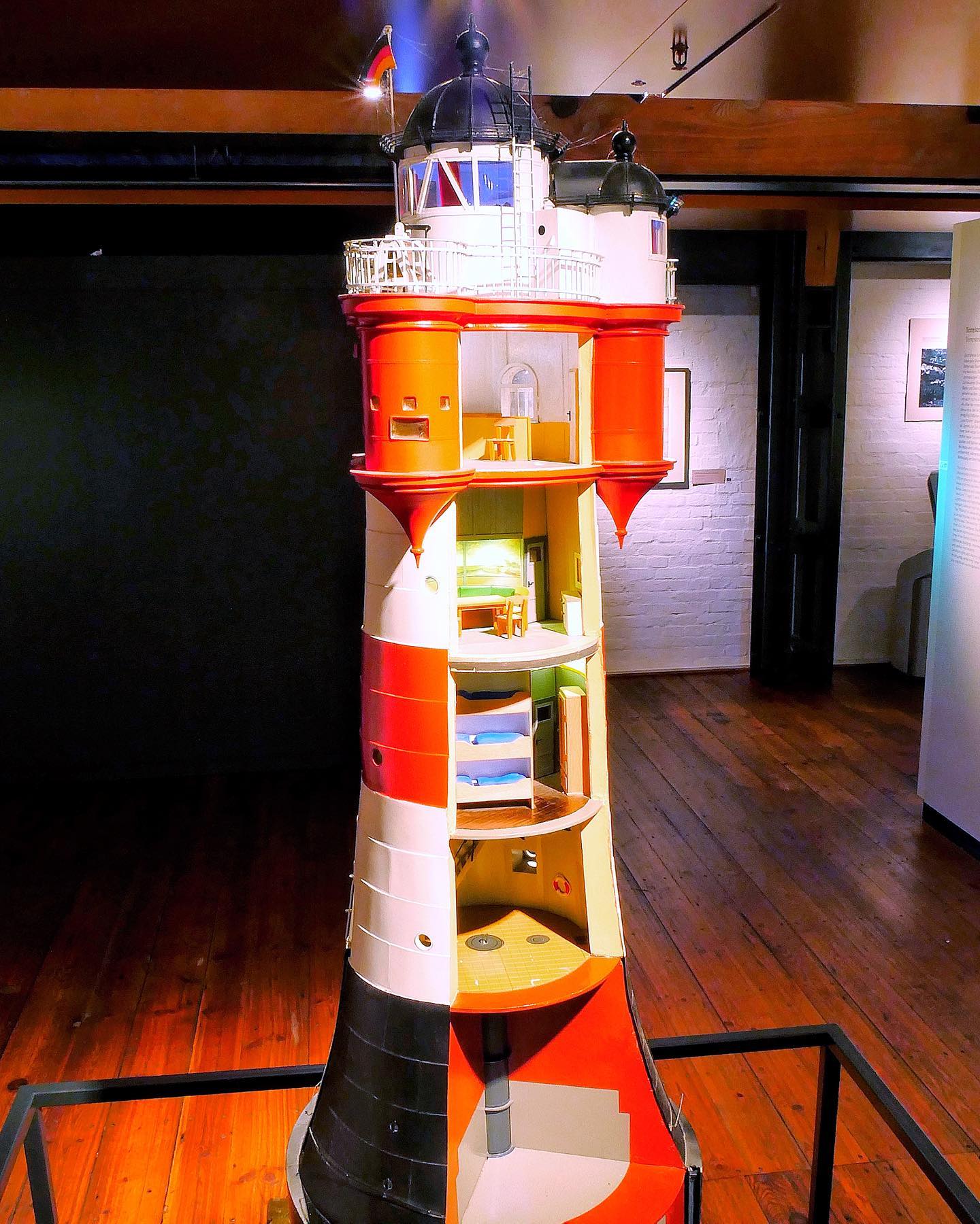
17 – Beacons
Audioguide:
The earliest navigation was mostly along the coasts. Orientation was provided by mountains, groups of trees and later buildings. Marked points were recorded as so-called „Vertoonungen“ in sea handbooks.
Barrels and stone towers were used as orientation aids to find one’s way around the coast. These fixed sea marks are called „beacons“. Lighthouses and lightships were used as navigation aids at night.
To this day, lighthouses are indispensable for shipping. Leading lights are also still in use. A leading light consists of a front light and a rear light. If you can see both signals in a line from on board, the ship is on course.
The history of lighthouses goes back to the 3rd century BC. As early as the time of the Roman Empire, several dozen lighthouses stood on the coasts of the Mediterranean.
The „Roter Sand“ lighthouse at the mouth of the Weser is particularly well known. The characteristic tower stands as a symbol for the emigration waves of the late 19th century. For many emigrants, „Roter Sand“ was the last thing they saw of their homeland.
The „Faro de Punta del Hidalgo“ lighthouse is located on Tenerife in Spain. It is considered an architecturally particularly successful example of modern maritime beacon construction.
Currently not on display:
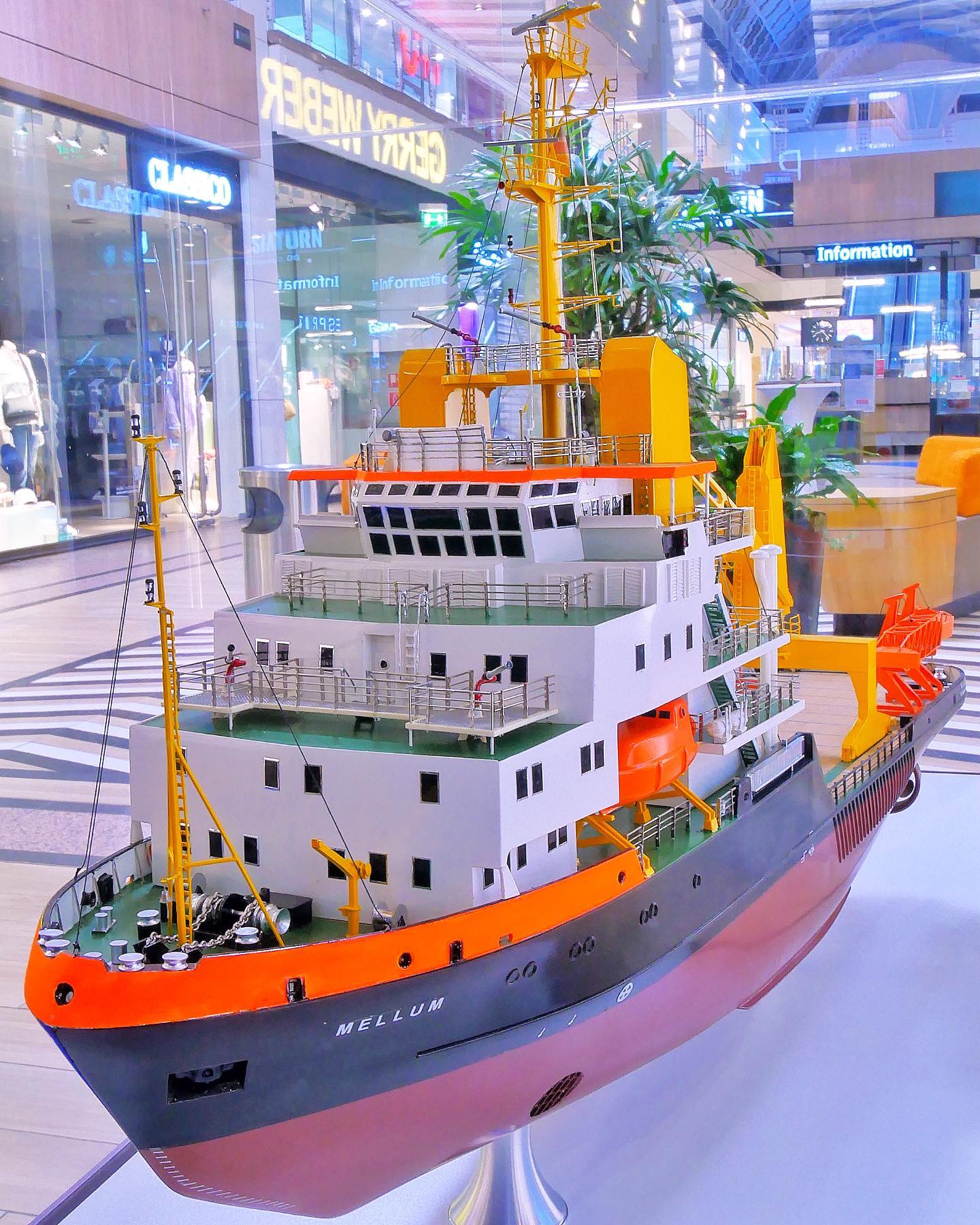
18 – Shipping Simulator
Audioguide:
On deck 1 you will also find our shipping simulator. On the bridge of the „Tokyo Express“ you can be at the helm! Head for the ports of Rotterdam, Singapore and Hamburg on board a container ship. Under the expert eyes of our captains, you can steer a 300-metre-long large container ship through different areas. Public cruises take place on a regular basis.
The online exhibition guide is funded by: